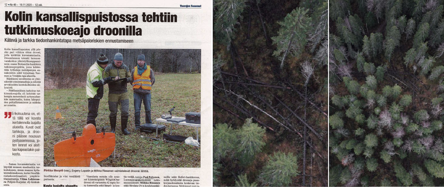
Test flight of the WingtraOne drone in Koli National Park
At the beginning of November, as part of the CBC Biokarelia project's fieldwork, a drone test flight was made in Koli National Park. Because the drone is an extremely sensitive equipment, a rainless and low wind day was chosen for its testing.
Present during the testing were Eugene Lopatin (the project coordinator), and Miikka Rissanen (research assistant) from the Natural Resources Institute Finland, Pasi Poikonen, coordinator of the Bofori project, and Vilma Lehtovaara, Biosphere Reserve coordinator from the ELY-center. Pirkka Herpiö, a training manager from Skydata ltd was responsible for aviation safety during the day. Journalists from the provincial newspaper Karjalainen and the local newspaper Vaarojen Sanomat also joined the test launch.
The purpose of the drone- flight was to test the WingtraOne drone and to collect comparable data with several different drones and cameras. The flights could help develop a flight protocol and test the accuracy of these devices. What matters is not only its ability to capture high resolution images, but also how accurately it can record the location of the captured images. Drones are used in the Biokarelia project to assess the locations and amount of decaying wood, to allow map biodiversity and collect necessary data for forest fire forecasting.
After the initial preparations, the take-off took place swiftly aided by two propellors. After reaching the flight altitude, it started following the predefined flight path. The intention was to cover an area of 140 hectares within an hour’s flight. Two similar flights were made; in the first flight the drone was equipped with a standard RGB camera (42 mpix Sony) and in the second flight a multispectral camera (MicaSense RedEdge) was used. The same flight path was covered using Matrice and Mavic drones. Due to small technical problems, only 60% of overlapped area was covered. The intention was not to increase coverage area, but rather to get overlapping data with various drones equipped with various sensors, so that the data could be combined and compared.
Since this was a BVLOS (Beyond Visual Line-of-Sight) flight over a wide area, a permission was required from the Defence Forces and the Airspace Management Cell (AMC). The airspace was reserved for flights up to 140 meters since the space above it was in use by the Air Force on the same day. The airspace was not closed but a temporary danger was declared.
Evgeny Lopatin described the reasons for choosing the used drone: "The WingtraOne drone is a hybrid of a helicopter and an airplane, as it rises vertically like a helicopter it does not require a runway. In the air, the device is in plane mode, and utilising the lift from the wing, it can cover large areas with reduced power consumption."
According to Herpiö, the resolution of the image obtained commonly with satellites is 60-70 cm / pixel, the WingtraOne drone can reach an accuracy of 1 cm / pixel. However, this type of data gathering does not replace the satellite data but rather enhance each other. The position accuracy of the images taken by the drones was improved to millimeters accuracy using GPS signal of the RTK GNSS receiver at the flight area.
Vast amounts of imagery data were gathered from the flights. About 1,600 images were captured on the first flight and each image was about 17 MB in size. With the multispectral camera, the image sizes were slightly smaller," says Miikka Rissanen. According to Lopatin, the gathered material is processed using a Puhti supercomputer. With various computer programs, the images can also be used to create a 3D model of the area.
Next summer, the plan is to carry out additional test flights and try altitude of up to 400 meters. According to Lopatin, in favourable weather conditions, it is possible to cover an area of up to 9km2 in one flight. For example, the 30km2 area of Koli National Park could be fully covered in a just few flights.